Thursday, July 10, 2014

3716.3 Sunrise to Sunset

We left on a Wednesday morning at sunrise, to beautiful rays of sun beaming down on the Eastern Plains of Colorado.  We returned on a Wednesday evening at sunset, to rays of sun beaming down on the Rocky Mountains from Long's Peak to Pike's Peak.  Yellow-Orange-Gold fireworks that no man can imitate.  What a perfect way for God to conclude our trip.

The trip odometer says 3716.3.  That is a measure of miles.  But how can we measure precious times, shared experiences, laughter, awe?  I don't think we can.  But we can be thankful.  That I am.

Tuesday, July 8, 2014

Hoosier Hill, Bridge Out, Baseball, and How to Make Friends in Rural America

Siri said go west.  We went.  Siri said go south.  We went.  Siri said go west.  The sign said "Bridge Out, 5 Miles."  We went West anyway, on US 36 (which eventually goes to Boulder, Colorado), only to arrive at a sign that says, "Road Closed 3 Miles Ahead, Local Traffic Only"

Not to be discouraged or defeated, since the actual high point was only ten miles beyond, we plotted a course through the lesser farm roads of Ohio and Indiana with our map app.  Left here, right there.  We came to the tiny village of Hollansburg, Ohio and dropped off a postcard.  Up the street all the cars from all around were parked in a field at roadside.  What???  Ah, little league baseball.  There's still hope for America after all.  How completely charming!  I wanted to stop and pick a team to cheer for, but Alex wouldn't let me.  Too shy.  Too embarassing.

On the other side of town, the roads got more narrow, down to single lanes between corn fields.  Suddenly we came out at Bethel, and a zig zag later we found the Highest Point in Indiana, Hoosier Hill.  3 students from a local college were there, signing the logbook.  It was their first highpoint, my 24th, and Alex's 14th.  We all had a few minutes pleasant chat, and went our ways, the chance meeting having run its course.  It seemed remarkable that the five people who visited the high point that day all happened to be there at the same time.

The ten miles south of Bethel to Interstate 70 were an up and down roller coaster ride unlike any other.  We both got that funny feeling in our stomachs many times.  Interstate.  Nothing happens on the interstate, does it?

Campbell Hill, Ohio: The Business Park

What a relief it was, the stress completely gone, when we turned off the interstate and headed along the lesser byways toward Bellefontaine, Ohio through the rolling farmlands.  A right turn and a brief jaunt brought us to the campus of a job training center, and the highest point in Ohio, Campbell Hill.  There were no signs from the highway, and we had to go on the ten year old guidebooks to thread our way through the parking lots to the top of the hill.

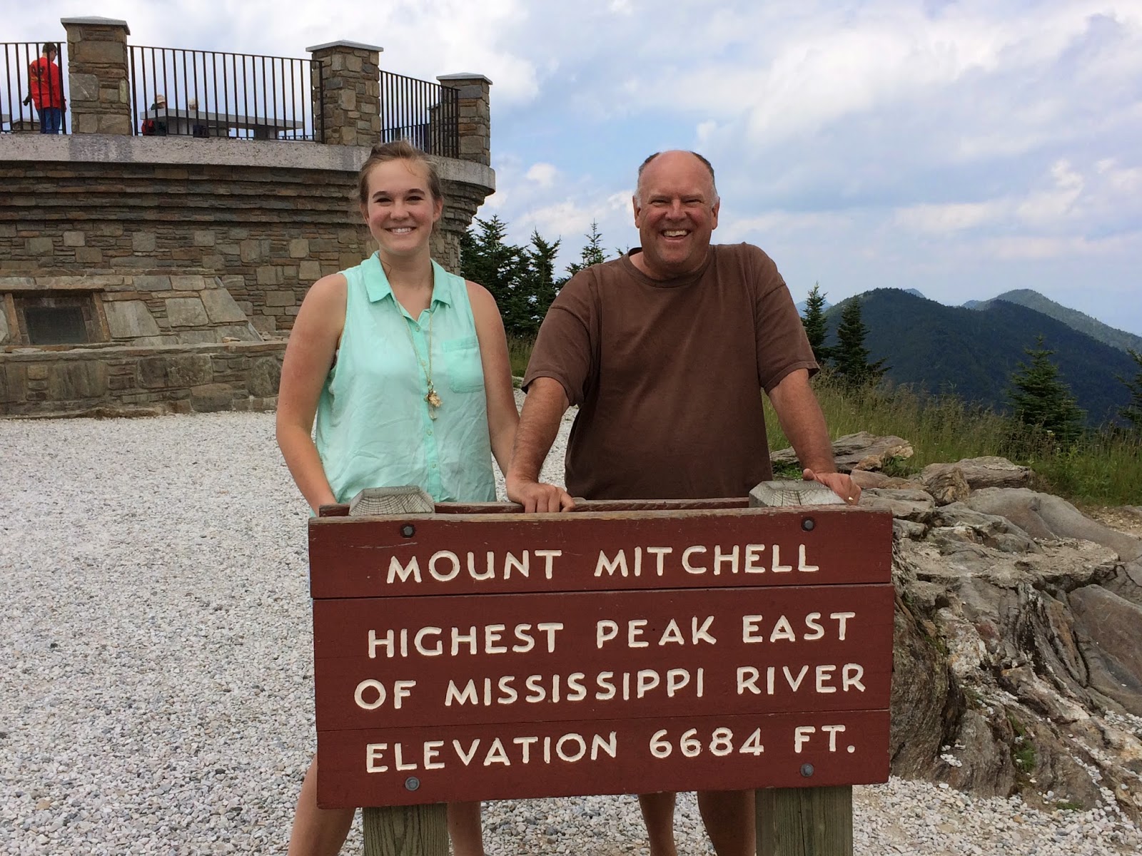
So it wasn't Clingman's Dome or Brasstown Bald.  We had fun findin
g it.  My comment: highpointing is like a cross country scavenger hunt.  Road trip plus navigating skills plus a little bit of deduction along the way.  We bond, we team up, we solve problems, we listen to podcasts.  Four hour podcasts on the siege of Muenster in 1536.  Wow, Dan Carlin, you are a great narrator of history. Highly recommended for road trips or lengthy hospital stays.  Any time with time to listen.  Hardcore History with Dan Carlin.  Itunes it.

We dialed in Bethel, Indiana to the Iphone maps app and headed out for what we expected would be an uneventful 90 minute drive to Hoosier Hill.  We were wrong.  Siriously wrong.

The Interstate 75 Parking Lot

Gatlinburg, Tennessee has the greatest assembly of miniature golf courses in the world.  Every possible theme and combination of themes is here.  Jungle, Mine, Treasure, Dinosaur and Dinosaur Mine Treasure Jungle Miniature Golf.  And really, its a good thing to have so many recreational opportunities considering the density of pancake houses in the greater Gatlinburg area.  You have to burn those calories somehow!

This morning I got to thinking about Cherokee and Gatlinburg, and decided they're kind of a twin cities Disneyland for folks in the region.  And, I really like the idea that everything is so family oriented.  Every last thing is tailored to family.  So, yeah, it's plasticville, but at least it's family plasticville.  It's a bit weird to have all the Disneyland stuff on either side of the National Park, which shouts that the Great Smokies really aren't all that great, and that there might be bugs and snakes and bears and steep hills to hike up. 

Today's goal was to capture the Ohio and Indiana high points, hundreds of miles north via three or four interstates.

Everything was going super well, when, north of Knoxville it happened.  Total stoppage.  Like, turn off the engine and wait it out.  The hands of the clock moved half an hour.  Then we began to inch forward at under 5 miles an hour.  The curves in the road hid the incident, so we speculated: nothing? fatal accident? Road worker injury?  A memory crept in from a family vacation of more than forty years ago.  We four in the family Country Squire station wagon in southern Oklahoma.  Traffic at a standstill on a two lane highway.  My dad was a war veteran and raised always to go see what he could do for anyone.  He walked ahead to the scene.  Some time later he came back very shaken.  Family of seven, killed at a railroad crossing. 

We inched forward, and there it was, a burned out jumbo RV, still smoldering.  On to Lexington, Cincinnati, and western Ohio.  

Monday, July 7, 2014

Clingman’s Dome, Tennessee, the Mysterious High Point

I am doing this without a paper map.  First time ever.  I am now a cell phone tower addict.  If I can’t get bars, I can’t get anywhere.  Last night I jotted down a few directions, and really, they worked to perfection.  We got to highpoints 1 and 2 with no problem whatsoever.  Highpoint 3, Clingman’s Dome, is smack in the middle of The Great Smoky Mountains National Park.  I google mapped it and along we went to Cherokee, North Carolina. 

Indian dancers, indian jewelry, indian wrestling, indian curios, indian souvenirs, indian casinos.  Ugh. And Santa’s Land.  Double ugh. Not a shred of decency or dignity but they’re making money hand over fist.  The love of money is the root of all kinds of evil.  The Cherokee forefathers must be spinning in their graves.  Or maybe writhing in envy at all the dough.  Blessed be the rear view mirror in which Cherokee fades into the distance.

The Tennessee High Point is the most visited of all 50 state high points.  At Taum Sauk Mountain, Missouri, not a car in the parking lot.  Here, it looked like Yosemite Valley on the Fourth of July.  License plates: Quebec, Florida, Georgia, North Carolina, South Carolina, Tennessee, California, Iowa, and a good many others.  It reminded me of the license plate menagerie in the Disneyland Parking Lot.  Languages: English, French, Spanish, Russian, and Hillbilly.  That last one is completely inscrutable to all but the most PhD’d Linguist. 
We were somewhat mystified by the crowds.  Sure, the view is spectacular.  Sure, it’s smack dab in the middle of the only really great national park on the eastern seaboard.  Sure, it’s within a few hours of a lot of people, but really… most visited?  I guess the climb up Denali scares off a few folks. 

At the north entrance of the Great Smoky Mountains National Park is Gatlinburg, Tennessee.  Remember everything I said about Cherokee, North Carolina that you were vaguely or not so vaguely offended at?  Gatlinburg.  Worse.  Everything touristy.  Tourist shops of every description.  Every kind of restaurant, every possible theming of hotels from Bavarian to Beaver.  Triple ugh. 

Yet, Google Maps said we are four and a half hours from the highest point in Kentucky.  Yikes.  Who said it would take 11 hours to do all four?  Google Maps, that’s who.  Minus the stops, of course.  Now it says we would not arrive until after 10 PM, an odyssey of 14 hours, and an arrival in the depths of coal mining country, at a reportedly bleak high point.  We strike this one off the list, settle for a comfy hotel in tourist perdition, and order pizza and salad.  It was a really, really, great day.

Tomorrow we head for Bellefontaine, Ohio and Campbell Hill.  We will head in the direction of Home from there!


Mount Mitchell, North Carolina, Appalachian High

A short while later, we were back on the four lane, and then the interstate, I26 to I40 near Asheville, North Carolina.  Destination: the highest point East of the Mississippi River, Mount Mitchell, North Carolina.  Our time on the interstate was mercifully brief, and unbeknownst to us, our navigator had a special treat in store for us.  The Blue Ridge Parkway was our home for the next 70 glorious miles.  Not long after I realized we were on one of the great highways of our land, I had a brilliant idea: Beethoven’s 6th Symphony, “Pastoral.”  The music and the scenery seemed to blend perfectly until almost the very top of the mountain.  Even the timing was seemingly perfect.  Appalachian High, Carolina!

By the time we reached the summit parking lot, it was legitimately chilly.  The jaunt to the top is quick; the view again breathtaking, rivalling its neighbor in Georgia. 


My question: “Why do all these high points have to be on the top of mountains?”  We then speculate what it would be like to visit all the lowest points in all the states.  W
e decide not to make plans.

Sassafras Mountain, South Carolina

Sassafras Mountain is just up from Rocky Bottom, South Carolina.  Yes, Rocky Bottom is indeed a tragic medical condition.  Simply incurable.  That’s why they have the Rocky Bottom Colony there, so that the sufferers can endure to the end apart from the public eye.  Even Siri sounded dubious when she said, “You have arrived in Rocky Bottom.”  The Siri is a real person theory gets some serious confirmation.

We noticed that people actually sit on their porch in these parts.  It’s a thing.  They watch the world go by, I guess.  Woman on the porch in Rocky Bottom, South Carolina, this post is for you.  I am sorry for your condition, really I am. 

The drive from Hiawassee, Georgia to Rocky Bottom was lovely.  There are subtle changes in terrain and foliage and climate.  The forest seems thinner and the air thicker, the mountains gentler.  Up from Walhalla, South Carolina the road was tremendous fun in our little Hyundai, zipping up down and around like the little coup that could. 

The top of the mountain was just a bunch of trees.  We couldn’t see anything.  And it was next to some kind of transmitter.  Unlovely.  Nice overlook at the end of the parking lot, but this was no Brasstown Bald.  Still, a pretty spot on a pretty road that runs between two picture postcard towns, Walhalla, SC and Rosman, NC.  On the list of places I could live if ever Colorado is obliterated by a volcano or asteroid, this area I think could be more than acceptable.  It worked really well for Father Tim.

The Fantastic Four... erm, Three

With perfectly good intentions, we went to bed last night with the idea of sleeping in, doing some leisurely reading, and getting on the road by ten.  At 6:30 AM we stared at each other and agreed to get rolling.  South Carolina, North Carolina, Tennessee, and Kentucky beckoned.  Google Maps said we could do it in 11 hours. Not including hiking time, eating time, stamp buying time, and the many other times that intrude on a perfect day of automobile transit.11 hours sounded very doable.  Very... doable...

I write this from Gatlinburg, Tennessee in case you're one of those people who read the last page of the book to solve the mystery.  But I'm not saying whodunit or how.  I'm at a nice streamside motel room, digesting pizza and salad, and all is right with the world.

Read on!

Sunday, July 6, 2014

Georgia on Our Minds...

Tullahoma faded in our rear view mirror.  Two and a half special days with friends in wonderful Christian fellowship, capped with a communion service.  We cut across wooded countryside to interstate 24 and headed for Chattanooga, and soon we were headed down the Old Copper Road toward the Occee River recreational area.  Hundreds and hundreds of rafters and kayakers were braving the roaring cascade as we zoomed through the river canyon on the way to Blairsville, Georgia, our jumping off town for Brasstown Bald.  We played hopscotch through the states: Tennessee... North Carolina... Tennessee... Georgia... North Carolina... Georgia.  Then Blairsville and a seventeen mile jaunt to the high point trailhead.  Except instead of going south somehow we ended up going west on the Blue Ridge Highway until at eight miles we realized we weren't in Kansas anymore and turned around.  We then righted ourselves, found Georgia 180, and before we knew it we were having a blast on the tight turns of the drive to the trailhead parking.

Brasstown Bald involves a 1.2 mile round trip hike up an asphalt trail.  It isn't Mt. Elbert, but it's plenty steep and got our hearts pumping for a short while.  This was my 19th state high point.  And... I am 19 for 19. Every last one has been worth it, and always for different reasons.  This one was a no brainer.  A panorama that is hard to rival anywhere. Thousands of square miles covering four states stretched into the hazy distances.  I am a softy.  I got choked up for a moment, thinking about my many blessings, God, friends, country, and my dear family.


Finally the comforts of a hotel room in Hiawassee, Georgia called to our weary bodies, and we descended.  As we drove into the lake community, we viewed the distant tower of the Bald, and marveled at how far we'd come in just a half an hour.  We settled into our pleasant view of the lake and called loved ones.  Afterward we played Civilization V hot seat - a hotly contested game of wits.

Can we get four high points tomorrow? South Carolina, North Carolina, Tennessee, and Kentucky?  Not much margin for error in navigation!

Saturday, July 5, 2014

Interlude: Conference, Picnic, Hike, Friends

After two days on the road, a break with friends in Tullahoma, Tennessee.  We listened to many hours of excellent Bible teaching from Ron Merryman and Clay Ward.  We hiked to Machine Falls.  We watched a very impressive fireworks show.  We picnicked. We laughed and loved dear friends.  We discussed deep truths. We made new friends.  We didn't drive very far. Ha.

But, after church tomorrow... the road.  On to the highest point in Georgia!


Thursday, July 3, 2014

Cap America Road and the Walking Dead Location Scouts

Backstory.  Alex loves Captain America.  She has the T-shirt, watches the movies.  Knows the shield pose from the movie poster.  Favorite superhero status.  Still exuberant from the morning's beautiful high point, we are headed for Tullahoma, Tennessee and a Bible conference at Pleroma Bible Church.  Friends and Bible - it doesn't get any better than that!  Speeding along Missouri Highway 72, I glance over at a street sign.  Cap America Drive.  Hmmph.  Wait, what?!? "Alex, that was Cap America drive back there!  Let's take pictures!  We do.  Alex strikes the shield pose and click!  We laugh and beam for a mile or two from that one.  How could that blessing be random chance?  No way.

A few miles later, same highway.  Siri, our iPhone navigator says turn left.  We turn left.  We laugh nervously because the road is narrow and weedy, and honestly does look much more than sketchy.  A quarter mile later the weeds are waist high, and then we notice driftwood has washed across the road from a not so recent flood.  The road is blocked.  Beyond the driftwood a rusted iron bridge lies fallen into the Castor River or Cape Creek, I can't tell which.  We expect the Walking Dead to, well, walk at us from all directions.  What a creepy spot.  And the creepiness is not finished yet.

A hundred yards up the road there was a small cemetery.  Alex and I have to check this out.

Five or six rows of graves; ten or so graves across.  Some ancient stones.  Barely legible and not legible. One short row of just rocks as markers.  A sad one from 1906, a child born and died on the same day. Annalee Whitworth, "Our Precious Darling".  Another grace has a chiseled hand with the index finger pointing up.  What does it mean?  Look up? Will someone smush a pie in my face if I do?  Or does the finger forbid? Warn?  Are there evil spirits about?  Am I glad I am not here after dark?  But, we laughed, conversed, discussed, analyzed, and concluded: this was great!

On to Cape Girardeau, Vienna, Paducah, Nashville, and at last Tullahoma and friends.

Taum Sauk Mountain, Missouri

Our sleep was fantastic.  The odometer from yesterday's drive said 888.8 miles.  I did that (minus Alex's 30 or so miles near Mount Sunflower) on 4 hours of sleep.  I slept the sleep of the bone weary, mind-numbed but happy for our adventures.  Today was to be even greater than a really great yesterday.

We drove through hilly, forested, cool for July Missouri, passing the quintessential quaintness of old villages converted to bed and breakfasts and antique stores.  Alex became the high point navigator for the first time, reading from our guidebooks as we approached. Ironton and Arcadia, then turned onto the Taum Sauk State Park road. A few miles later we pulled into the spacious parking lot to... emptiness.  How could it be that on July 3rd, the day before the holiday, we were the only car visiting the highest point in Missouri? Inconceivable, but true.  We strolled though the forest to the spot, and... no sign.  A granite marker in the ground instead.  This makes for creative photo taking, and we had to lie on our backs and selfie with the marker between our heads.  Of course this was silly, which caused us to laugh and made for a great pic.  

My eighteenth and Alex's ninth high point.

Wednesday, July 2, 2014

What I Saw Today, A List

Billboards

The detritus of a civilization rotting from within:

Car Dealerships

Adult Books (Poorly named... not for emotionally mature adults)

Gentleman's Clubs (Poorly named... not for gentlemen)

Quick Cash for Gold

Bank: Rent Money Here!

Attend our college: Kansas, Kansas State, Missouri, Hays State

Museums

Cavalry Museum

Grandma's Kitchen

Western Fort

Dinosaurs!

Presidents Dwight D. Eisenhower and Harry S. Truman

Senators Arlen Specter and Robert Dole

Astronauts Joe Engle, Steve Hawley, Ron Evans (what is it with Kansas and astronauts?)

Roadkill

Raccoons;

porcupines;

fox;

coyote (probably)

badger (probably)

dogs;

cats;

birds;

unrecognizable mammalian species;

and birds eating the roadkill.

Back to the Sunflower

We were on the road shortly after 6 AM, driving East on I70 toward our ultimate destination in Saint Clair Missouri.  But with nearly 900 miles of driving and one state high point in between, we expected much to happen in the chewy middle of our drive.  We were not disappointed.  It was a gourmet day.

Was it uneventful first thing in the morning?  No.  We followed a night time rain, and the morning clouds were mixed, with rays of the sun bursting through like buckshot through a tin roof, making brighter green splotches on the Eastern Plains as they rolled alongside the ribbon of our highway.  This is the way to start a road trip - hope-filling sunshine and midsummer green prairies.

But duty intrudes.  Alex has just gotten her driver's permit, and we must practice.  We take Kansas exit 1 and pull over with the car pointing south on 3 Road.  It's her turn to drive and my turn to be terrified.  She has a total of an hour behind the wheel as we lurch onto the dirt road to the ever imposing Mount Sunflower. "Slow down. Speed up.  Stay away from the shoulder.  Stay out of the middle.  Slow down for limited sight distance and unsigned crossroads.  Don't hit the bird. Don't hit the jackrabbit. That is one huge jackrabbit."  I look down to check directions in our guidebook.  I look up we are doing 65.  What?!?  I look at the odometer.  I look up.  Veering right, then left.  Gulp.  She's doing better.

At last our turn for the Mount, and memories of six years ago flood in. My son is grown, my daughter is a beautiful, funny, intelligent, godly fifteen year old.  In between lie six years of the slice of American life for Turner: high school football, family vacations, fights, reconciliations, camps, laughter, tears, and ultimately, love and pride.

Like every high point I've visited, this is a place of unique beauty.  It is quiet.  Not a single motor can be heard: not a jet engine, car, tractor, not anything.  Just the breeze on the grass.  In the distance, the corrugated steel cone top of a huge silo lies in a field, blown there who knows when, and who knows where its orphaned cylinder stands.  No one has bothered to recover it.  It is lonely here.  We sign the guidebook, take photos, laugh, revel, and put the scene in the rear view.  We continue south to Weskan, Kansas, and east to Oakley.  The ribbon of the road rolls out before us, up and down, left and right, hidden and revealed.

Kansas changes from plains to forests and dry washes to creeks and even rivers.  Suddenly, Kansas City looms on its bluff, imposing and brash, and is gone behind.  The Wide Missouri River rolls under us near sunset, and again at dusk, the church spires of Washington, Missouri highlighted in the cool of the evening.  We power down the windows.  It is unseasonably cool for July, only in the 60s.  The night smells of cut grass and wood smoke please our nostrils.  The darkening greens of dusk our eyes.  The wind our skin.  We float around the curves of Missouri 47.  And then Siri tells us that we have arrived at our destination.

The Budget Lodging in Saint Clair!  An old style motor hotel with keys and views and a swimming pool in the parking lot.  The Bible is open to Proverbs 3:24:  "When thou liest down, thou shalt not be afraid; yea, thou shall lie down, and they sleep shall be sweet."

Tuesday, July 1, 2014

Tomorrow, the Road.

Tomorrow, the Road.

This morning our son left our home for the last time as a member of our own household.  He is on his own as an adult.  On Wednesday, July 16th, 2008 we left on our first highpointing trip, bagging Nebraska and Kansas in a single day, and Oklahoma the next.  That was just under six years ago.  He is now preparing to be a world traveler and missionary at Moody Bible Institute in Spokane, Washington.  In our brief career we climbed, walked, and drove up to 17 state highpoints.  We had a lot of fun and bonded together in our father-son relationship.  God blessed the original idea, and honored the thought that these adventures on road and hill and mountain would be a nice easel on which to paint a relationship and see our beloved country.  We did.

Tomorrow morning is a new day.  My beautiful daughter is 15 and ready to get to know her dad and have some fun, quirky adventures along the way.  Different car; different child; new highpoints.  We will begin our 3300 mile journey with Mount Sunflower, Kansas, and finish with Panorama Point, Nebraska, the first two Turner and I did together.  In between: Missouri, Indiana, Ohio, Illinois, and Iowa... five new summits to locate and conquer.  Though perhaps summits is too much of a word for the high points of the Great Plains.  Tomorrow, the road.  Tomorrow.