Tuesday, July 8, 2014

Hoosier Hill, Bridge Out, Baseball, and How to Make Friends in Rural America

Siri said go west.  We went.  Siri said go south.  We went.  Siri said go west.  The sign said "Bridge Out, 5 Miles."  We went West anyway, on US 36 (which eventually goes to Boulder, Colorado), only to arrive at a sign that says, "Road Closed 3 Miles Ahead, Local Traffic Only"

Not to be discouraged or defeated, since the actual high point was only ten miles beyond, we plotted a course through the lesser farm roads of Ohio and Indiana with our map app.  Left here, right there.  We came to the tiny village of Hollansburg, Ohio and dropped off a postcard.  Up the street all the cars from all around were parked in a field at roadside.  What???  Ah, little league baseball.  There's still hope for America after all.  How completely charming!  I wanted to stop and pick a team to cheer for, but Alex wouldn't let me.  Too shy.  Too embarassing.

On the other side of town, the roads got more narrow, down to single lanes between corn fields.  Suddenly we came out at Bethel, and a zig zag later we found the Highest Point in Indiana, Hoosier Hill.  3 students from a local college were there, signing the logbook.  It was their first highpoint, my 24th, and Alex's 14th.  We all had a few minutes pleasant chat, and went our ways, the chance meeting having run its course.  It seemed remarkable that the five people who visited the high point that day all happened to be there at the same time.

The ten miles south of Bethel to Interstate 70 were an up and down roller coaster ride unlike any other.  We both got that funny feeling in our stomachs many times.  Interstate.  Nothing happens on the interstate, does it?

Campbell Hill, Ohio: The Business Park

What a relief it was, the stress completely gone, when we turned off the interstate and headed along the lesser byways toward Bellefontaine, Ohio through the rolling farmlands.  A right turn and a brief jaunt brought us to the campus of a job training center, and the highest point in Ohio, Campbell Hill.  There were no signs from the highway, and we had to go on the ten year old guidebooks to thread our way through the parking lots to the top of the hill.

So it wasn't Clingman's Dome or Brasstown Bald.  We had fun findin
g it.  My comment: highpointing is like a cross country scavenger hunt.  Road trip plus navigating skills plus a little bit of deduction along the way.  We bond, we team up, we solve problems, we listen to podcasts.  Four hour podcasts on the siege of Muenster in 1536.  Wow, Dan Carlin, you are a great narrator of history. Highly recommended for road trips or lengthy hospital stays.  Any time with time to listen.  Hardcore History with Dan Carlin.  Itunes it.

We dialed in Bethel, Indiana to the Iphone maps app and headed out for what we expected would be an uneventful 90 minute drive to Hoosier Hill.  We were wrong.  Siriously wrong.

The Interstate 75 Parking Lot

Gatlinburg, Tennessee has the greatest assembly of miniature golf courses in the world.  Every possible theme and combination of themes is here.  Jungle, Mine, Treasure, Dinosaur and Dinosaur Mine Treasure Jungle Miniature Golf.  And really, its a good thing to have so many recreational opportunities considering the density of pancake houses in the greater Gatlinburg area.  You have to burn those calories somehow!

This morning I got to thinking about Cherokee and Gatlinburg, and decided they're kind of a twin cities Disneyland for folks in the region.  And, I really like the idea that everything is so family oriented.  Every last thing is tailored to family.  So, yeah, it's plasticville, but at least it's family plasticville.  It's a bit weird to have all the Disneyland stuff on either side of the National Park, which shouts that the Great Smokies really aren't all that great, and that there might be bugs and snakes and bears and steep hills to hike up. 

Today's goal was to capture the Ohio and Indiana high points, hundreds of miles north via three or four interstates.

Everything was going super well, when, north of Knoxville it happened.  Total stoppage.  Like, turn off the engine and wait it out.  The hands of the clock moved half an hour.  Then we began to inch forward at under 5 miles an hour.  The curves in the road hid the incident, so we speculated: nothing? fatal accident? Road worker injury?  A memory crept in from a family vacation of more than forty years ago.  We four in the family Country Squire station wagon in southern Oklahoma.  Traffic at a standstill on a two lane highway.  My dad was a war veteran and raised always to go see what he could do for anyone.  He walked ahead to the scene.  Some time later he came back very shaken.  Family of seven, killed at a railroad crossing. 

We inched forward, and there it was, a burned out jumbo RV, still smoldering.  On to Lexington, Cincinnati, and western Ohio.  

Monday, July 7, 2014

Clingman’s Dome, Tennessee, the Mysterious High Point

I am doing this without a paper map.  First time ever.  I am now a cell phone tower addict.  If I can’t get bars, I can’t get anywhere.  Last night I jotted down a few directions, and really, they worked to perfection.  We got to highpoints 1 and 2 with no problem whatsoever.  Highpoint 3, Clingman’s Dome, is smack in the middle of The Great Smoky Mountains National Park.  I google mapped it and along we went to Cherokee, North Carolina. 

Indian dancers, indian jewelry, indian wrestling, indian curios, indian souvenirs, indian casinos.  Ugh. And Santa’s Land.  Double ugh. Not a shred of decency or dignity but they’re making money hand over fist.  The love of money is the root of all kinds of evil.  The Cherokee forefathers must be spinning in their graves.  Or maybe writhing in envy at all the dough.  Blessed be the rear view mirror in which Cherokee fades into the distance.

The Tennessee High Point is the most visited of all 50 state high points.  At Taum Sauk Mountain, Missouri, not a car in the parking lot.  Here, it looked like Yosemite Valley on the Fourth of July.  License plates: Quebec, Florida, Georgia, North Carolina, South Carolina, Tennessee, California, Iowa, and a good many others.  It reminded me of the license plate menagerie in the Disneyland Parking Lot.  Languages: English, French, Spanish, Russian, and Hillbilly.  That last one is completely inscrutable to all but the most PhD’d Linguist. 
We were somewhat mystified by the crowds.  Sure, the view is spectacular.  Sure, it’s smack dab in the middle of the only really great national park on the eastern seaboard.  Sure, it’s within a few hours of a lot of people, but really… most visited?  I guess the climb up Denali scares off a few folks. 

At the north entrance of the Great Smoky Mountains National Park is Gatlinburg, Tennessee.  Remember everything I said about Cherokee, North Carolina that you were vaguely or not so vaguely offended at?  Gatlinburg.  Worse.  Everything touristy.  Tourist shops of every description.  Every kind of restaurant, every possible theming of hotels from Bavarian to Beaver.  Triple ugh. 

Yet, Google Maps said we are four and a half hours from the highest point in Kentucky.  Yikes.  Who said it would take 11 hours to do all four?  Google Maps, that’s who.  Minus the stops, of course.  Now it says we would not arrive until after 10 PM, an odyssey of 14 hours, and an arrival in the depths of coal mining country, at a reportedly bleak high point.  We strike this one off the list, settle for a comfy hotel in tourist perdition, and order pizza and salad.  It was a really, really, great day.

Tomorrow we head for Bellefontaine, Ohio and Campbell Hill.  We will head in the direction of Home from there!


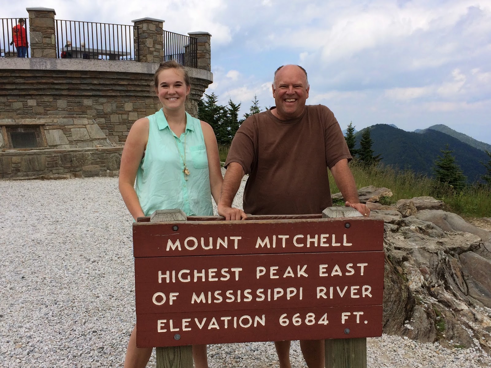
Mount Mitchell, North Carolina, Appalachian High

A short while later, we were back on the four lane, and then the interstate, I26 to I40 near Asheville, North Carolina.  Destination: the highest point East of the Mississippi River, Mount Mitchell, North Carolina.  Our time on the interstate was mercifully brief, and unbeknownst to us, our navigator had a special treat in store for us.  The Blue Ridge Parkway was our home for the next 70 glorious miles.  Not long after I realized we were on one of the great highways of our land, I had a brilliant idea: Beethoven’s 6th Symphony, “Pastoral.”  The music and the scenery seemed to blend perfectly until almost the very top of the mountain.  Even the timing was seemingly perfect.  Appalachian High, Carolina!

By the time we reached the summit parking lot, it was legitimately chilly.  The jaunt to the top is quick; the view again breathtaking, rivalling its neighbor in Georgia. 


My question: “Why do all these high points have to be on the top of mountains?”  We then speculate what it would be like to visit all the lowest points in all the states.  W
e decide not to make plans.

Sassafras Mountain, South Carolina

Sassafras Mountain is just up from Rocky Bottom, South Carolina.  Yes, Rocky Bottom is indeed a tragic medical condition.  Simply incurable.  That’s why they have the Rocky Bottom Colony there, so that the sufferers can endure to the end apart from the public eye.  Even Siri sounded dubious when she said, “You have arrived in Rocky Bottom.”  The Siri is a real person theory gets some serious confirmation.

We noticed that people actually sit on their porch in these parts.  It’s a thing.  They watch the world go by, I guess.  Woman on the porch in Rocky Bottom, South Carolina, this post is for you.  I am sorry for your condition, really I am. 

The drive from Hiawassee, Georgia to Rocky Bottom was lovely.  There are subtle changes in terrain and foliage and climate.  The forest seems thinner and the air thicker, the mountains gentler.  Up from Walhalla, South Carolina the road was tremendous fun in our little Hyundai, zipping up down and around like the little coup that could. 

The top of the mountain was just a bunch of trees.  We couldn’t see anything.  And it was next to some kind of transmitter.  Unlovely.  Nice overlook at the end of the parking lot, but this was no Brasstown Bald.  Still, a pretty spot on a pretty road that runs between two picture postcard towns, Walhalla, SC and Rosman, NC.  On the list of places I could live if ever Colorado is obliterated by a volcano or asteroid, this area I think could be more than acceptable.  It worked really well for Father Tim.

The Fantastic Four... erm, Three

With perfectly good intentions, we went to bed last night with the idea of sleeping in, doing some leisurely reading, and getting on the road by ten.  At 6:30 AM we stared at each other and agreed to get rolling.  South Carolina, North Carolina, Tennessee, and Kentucky beckoned.  Google Maps said we could do it in 11 hours. Not including hiking time, eating time, stamp buying time, and the many other times that intrude on a perfect day of automobile transit.11 hours sounded very doable.  Very... doable...

I write this from Gatlinburg, Tennessee in case you're one of those people who read the last page of the book to solve the mystery.  But I'm not saying whodunit or how.  I'm at a nice streamside motel room, digesting pizza and salad, and all is right with the world.

Read on!